00:00

Drive down the 400-mile scenic byway between San Francisco and Los Angeles on a multi-day road trip of the Pacific Coast Highway. Discover everything from a beachfront waterfall inside the expansive Julia Pfeiffer Burns State Park to the majestic redwoods of Big Basin. Wave to the elephant seals before hearing stories of old-Hollywood legends at spots like Hearst Castle and Nepenthe Cafe.
The 90-mile stretch of Big Sur lies along the route, with plenty of chances to hike the expansive wilderness nestled between the mountains and the Pacific that’s only accessible on this highway. We can enjoy a hike to the purple sand on Pfeiffer Beach here or even camp and explore the longer trails.
Next, cruise through surf towns like Malibu or relax over a meal in San Luis Obispo as you hear all the tales of Spanish exploration and settlement with the bonus walking tour here. As we drive, we’ll discover the sites where Chumash once drew a living from the sea and forest. We’ll point all the must-see stops along the included tours through 17-Mile Drive in Monterey and Santa Monica Pier in LA.
This tour can be driven in either direction, starting in either San Francisco or Los Angeles.

To enjoy the PCH driving tour, most either approach directly by car or arrive by plane into either San Francisco (North Starting Point) or Los Angeles (South Starting Point), then rent a car upon arrival. If you’re taking the entire drive, it’s easiest to fly into one airport and out of the other. If you are flying in and out of the same airport, we recommend returning via US-101, which provides additional California scenery through the wine country but avoids the twists and turns of PCH.
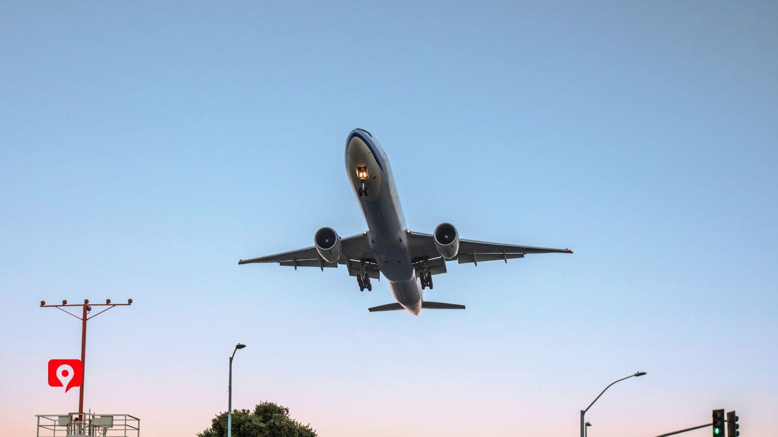
If flying into San Francisco, you’ll arrive at SFO. If flying into Los Angeles, you’ll fly into LAX. If you just want to focus on the Big Sur region for your trip, you could then take a short connecting flight to Monterey at MRY to get closer to the remote scenery.

Interstate 80 leads directly into San Francisco, and Interstate 10 leads you to Los Angeles. From there, it’s easy to pick up the tour narration at the starting points on our tour map.

Travelers arriving by Amtrak to Los Angeles can rent a car at Union Station and then rent a car to head to the Santa Monica starting point.
Travelers do not need to pay a fee to drive along the Pacific Coast Highway scenic byway. A California State Parks Pass will cover parking at most of the parks along our route, except the popular Pfeiffer Beach, which is managed separately and requires a parking fee at the on-site kiosk.
17-Mile Drive charges a vehicle entry fee. Pay this at any of the gates onto the Drive. Keep your receipt, as the fee will be reimbursed if you spend over $35 at any Pebble Beach restaurant (expcept Pebble Beach Market).
Attractions along the route like the Monterey Bay Aquarium, Mystery Spot, and Hearst Castle require an admission fee.

Camping inside Big Sur can be a memorable part of the experience, especially if you want to extend the trip over several days. There are camping options in State Parks along the route, ranging from tent camping to RV spots and comfortable cabins. Be sure to reserve well in advance, since campsites are in high demand. Reserve sites up to six months in advance at reservecalifornia.com.
Staying in Monterey lets you get an early start for the southbound option of our tour, plus you can visit the aquarium early in the day. South of Big Sur, Morro Bay and San Luis Obispo are convenient small towns with plenty of dining options within walking distance of accommodations.
If you want to combine your scenic drive with big-city sights, you can stay within Los Angeles or San Francisco city limits and then use that as a home base for driving the PCH.


Fall is the best time to drive the Pacific Coast Highway, especially the Big Sur portion. The fog is minimal, meaning you’ll have more breathtaking views in the mornings. The weather is comfortable for hiking in the state parks, and the summer vacation crowds have thinned out. Surfers speak highly of the fall swells for peak waves. Summer brings warm weather and a vacation feel, but more traffic.
The fog can sometimes linger until late morning. Spring is the rainy season, but this also means that the waterfalls in the many state parks here will be at peak volume. Even winter is a good time to drive the PCH and Big Sur – just make sure you check road alerts for closures and pack an extra layer of warm clothing, as the temperatures will vary as you change elevation along the drive.
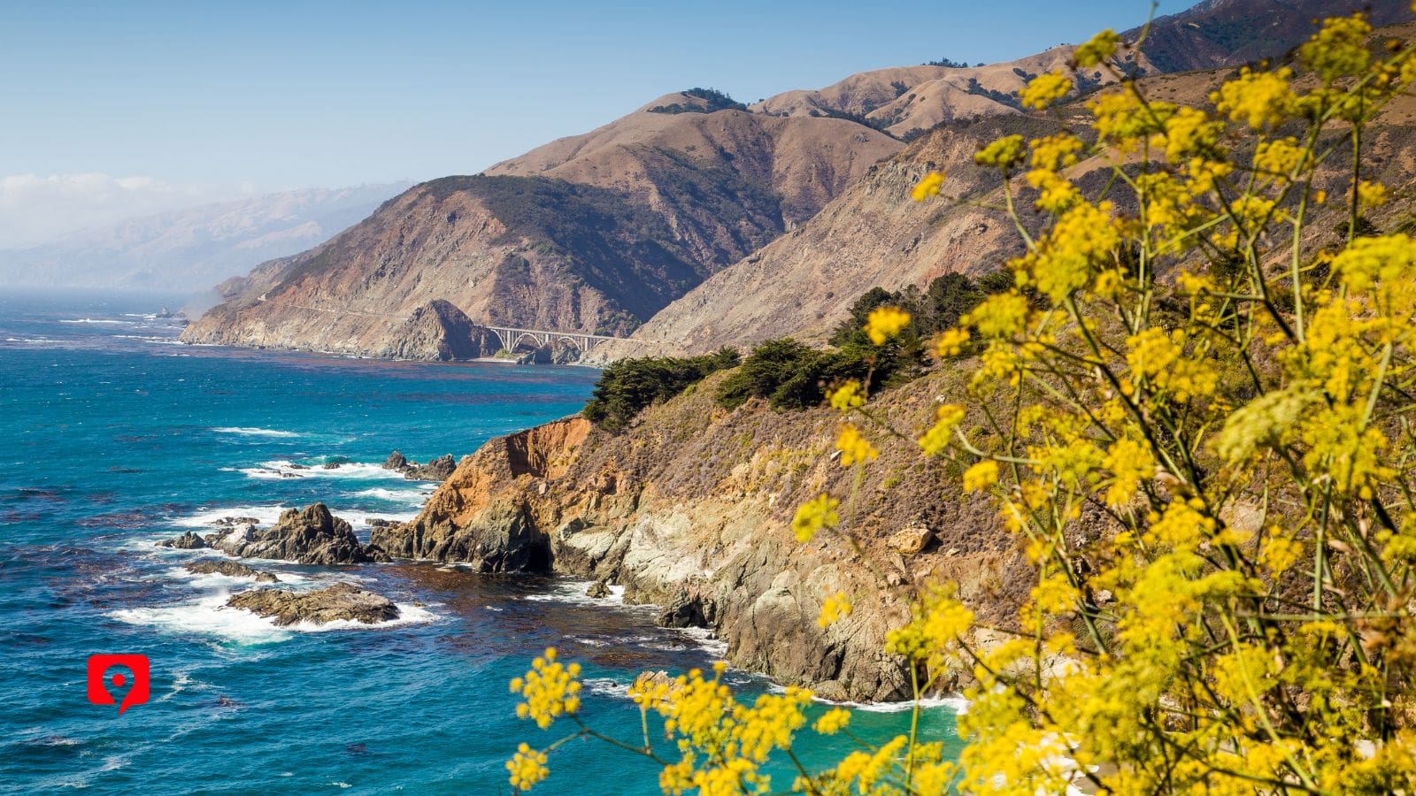
Just off Highway 1, down a single-track road, Pfeiffer Beach delights visitors with its natural rock formations that create arches and spirals rising dramatically from the Pacific Ocean. Coastal landscapes mingle here as sandy bluffs, stately forests, and a tumbling river all meet at the shore. The beach itself delights visitors with its purple-toned sand, a gift from the manganese garnet washed down as the surrounding cliffs gradually erode into the sea.

This sprawling protected forest is one of the most beloved places in Big Sur, thanks to its many easy trails and towering redwoods. Its most famous sight is an 80-foot-tall waterfall that spills directly onto a beach. The entire scene at McWay Falls looks like an illustration from an adventure novel – the waterfall empties into a crescent-shaped cove while bright blue waves pound the shore.

Built in the early 1900s by a publishing mogul, Hearst Castle is a sprawling complex of imported European treasures blended with West Coast innovation. Every inch of the buildings here incorporates some sort of artifact. Entire choir stalls were built into the walls. Priceless medieval tapestries hang in many of the rooms. Even the pool features an actual Roman temple! The entire ensemble, from the main building’s Spanish-style church facade to the Gothic statues, is truly a whimsical mishmash of styles.

See some of the favorite residents of western California at this perfect overlook, where you can safely view the seal families gathered together on the rocky coast. A bull seal can weigh up to 5,000 pounds, and the large marine mammals are found here in their extended family groups all year. This is the only spot where you can view elephant seals for free year-round, and it’s within an easy distance of Highway 1.

Named for the legendary Greek potion given to Helen of Troy to help her forget, Nepenthe is a one-of-a-kind restaurant perched 800 feet above the Pacific coastline in the mountains along the PCH. This idyllic spot has been a mecca for poets and artists for decades. Stop in for the views, and dine in the same spot as Elizabeth Taylor, Orson Welles, and Rita Hayworth while you watch the seabirds circle the waves below.

Just south of Carmel, this dramatic meeting of rock and water has been called “the crown jewel of the California park system.” Full of hidden coves, tide pools, Monterey cypress trees, and the dramatic play of light on water, it’s an endlessly photographable spot and one of the most diverse ecosystems in California. As an added bonus, you might spot dolphins, sea lions, or otters enjoying the rocky shoreline at the same time you are!

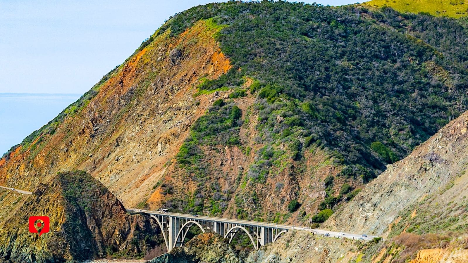
We guarantee you’ve seen this iconic concrete bridge in one of your favorite movies or shows – its dramatic rise over the mountains and deep, rocky gorge below are upstaged only by the endless Pacific Ocean stretching out beyond the horizon. 120 miles south of San Francisco, Bixby Bridge is one of the most memorable parts of driving along the Big Sur region in Central California along this scenic byway.

This popular beach town has a world-famous boardwalk, known as “the Coney Island of the West,” complete with amusement park and plenty of spots for beachfront relaxation. The riverfront town is a microcosm of California’s history, where the legacies of Spanish missionaries mingle with the true tales of pirate raids and disputes over statehood.
We guarantee you’ve seen this iconic concrete bridge in one of your favorite movies or shows – its dramatic rise over the mountains and deep, rocky gorge below are upstaged only by the endless Pacific Ocean stretching out beyond the horizon. 120 miles south of San Francisco, Bixby Bridge is one of the most memorable parts of driving along the Big Sur region in Central California along this scenic byway.
We guarantee you’ve seen this iconic concrete bridge in one of your favorite movies or shows – its dramatic rise over the mountains and deep, rocky gorge below are upstaged only by the endless Pacific Ocean stretching out beyond the horizon. 120 miles south of San Francisco, Bixby Bridge is one of the most memorable parts of driving along the Big Sur region in Central California along this scenic byway.

This waterfront street in Monterey was immortalized in John Steinbeck’s bestselling novel of the same name. Where once it was the home of a bustling 1920s factory, today it’s an energetic corner with shops and diners. The overhead walkways are a favorite of visitors – they are the repurposed remnants of the conveyor belt system that once transported canned fish across the wharf.

As the longest easily accessible beach within the 90-mile stretch of Highway 1 known as Big Sur, Sand Dollar Beach is the perfect break from driving and hiking. This half-mile stretch of sandy beach offers classic views of the peaceful ocean on one side, and the dramatic cliffs of the mountains on the other. Its a good spot for beachcombing – just make sure to return any living sand dollars back to the sea.

The Pebble Beach Resort and Golf Course greets visitors with an expansive golfing green along the coastline. Many people stop here to browse the upscale shops and bistros with endless vistas of the Pacific. The course itself is a work of art, as it blends seamlessly into the sand, stone, and water of the Monterey coast. Relaxing here feels like a truly luxurious experience. Visitors can book a golf game up to 24 hours in advance, but competition is stiff for a spot.

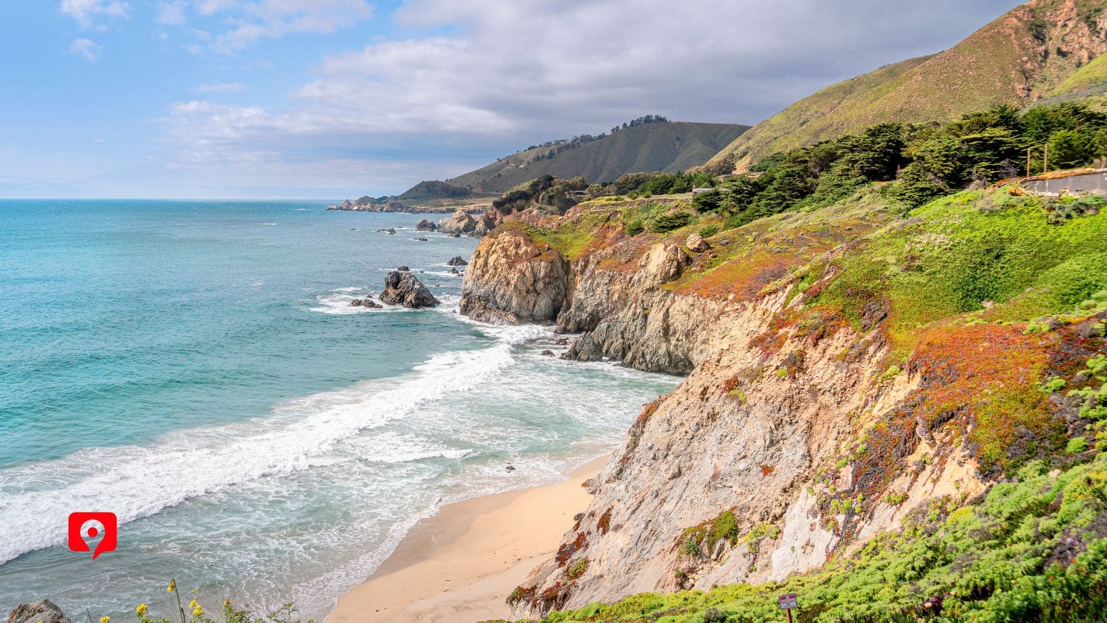
Fanshell Beach Overlook offers stunning views of a pristine, crescent-shaped beach framed by rugged rocks and the sparkling Pacific Ocean. The beach is known for its soft, white sand and turquoise waters, providing an idyllic setting for photography and relaxation. From this overlook, visitors can often spot harbor seals, especially during the pupping season in spring when the beach is closed to protect them. For those interested in wildlife and natural landscapes, Fanshell Beach serves as a perfect spot along the 17-Mile Drive.

Dating back to the 1790s, this is the classic example of Spanish Mission Architecture. The L-shaped church building forms the historic heart of San Luis Obispo, and tells the story of the Spanish Mission System, along with California’s layered past of Indigenous, Mexican, Spanish, and Anglo settlement over the centuries. Today, it’s an active parish and museum where visitors can breathe in the history along the pillars and breezeways.

This unique stretch of street inside the historic town is the perfect example of SLO’s lighthearted attitude. Since at least the 1950s, visitors and locals have decorated the walls with chewed gum, creating possibly the most unique mural in California and certainly one of the most memorable sights in town.

The world’s only solar-powered ferris wheel is the perfect spot to catch a California sunset over the Pacific Waves. Set amid the attractions of Pacific Park, the wheel symbolizes the dedication of generations of visionaries who built – and sometimes rebuilt – the little slice of paradise here.

The iconic sign that has welcomed visitors to the pier for over 80 years. The Arch marks the unofficial entry point to the legendary Santa Monica Pier, where visitors can wander among the Pacific Park’s attractions and relive their favorite scenes from the dozens of movies and music videos that have been filmed here through the years, from Forrest Gump to Miley Cyrus.

This easy, family-friendly trail is a short 0.4-mile walk that typically takes around 30 minutes. The paved overlook trail offers one of the most iconic views along the Pacific Coast Highway, featuring the stunning 80-foot McWay Falls cascading directly onto the crescent-shaped beach and scenic blue waves below. The route includes a short tunnel beneath Highway 1 and gentle elevation changes, making it accessible for most visitors. Parking can be limited during busy travel periods, so try to fit this one in early in the day to avoid crowds.

This moderately-easy 1.7-mile hike typically takes between an hour and an hour and a half. The trail winds through towering redwood stands in the heart of Big Sur’s rocky coastal region. The trail features shaded forest paths, a scenic footbridge, and several gradual uphill sections before reaching the peaceful Pfeiffer Falls viewpoint, where visitors can watch the waterfall tumble 60 feet down. The route is well-maintained but can be uneven and slightly muddy after rain, so sturdy shoes are recommended. This is a great option for hikers looking for a classic redwood forest experience without a strenuous climb.

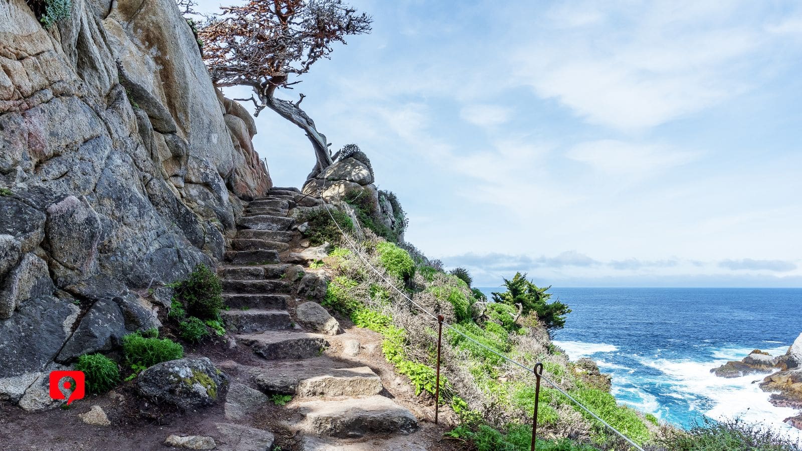
This easy 0.8-mile loop usually takes between 30 minutes and one hour and is one of the most scenic short hikes along the Monterey coast. The trail winds through a grove of rare Monterey cypress trees before opening to dramatic ocean overlooks, rocky coves, and turquoise water views. The path is mostly flat and well-marked, though there are a few uneven coastal sections. Wildlife sightings, including sea birds and harbor seals, are common throughout the reserve, making this a great choice for nature lovers.

Taken together, Sea Lion Point and Sand Hill Trail make a loop around Sand Hill that’s a perfect spot for viewing sea lions lounging on the rocks below. This easy one-mile coastal hike typically takes about an hour and combines some of the best ocean scenery in Point Lobos, including rugged cliffs and windswept cypress trees. The route includes mostly gentle terrain with a few sandy and uneven sections near the shoreline. This is an excellent trail for wildlife viewing and photography.

This easy 0.7-mile coastal trail generally takes between 30 minutes and one hour and offers sweeping views of the Pacific Ocean from rugged seaside bluffs. The route follows sandy paths and low coastal vegetation with several scenic overlooks perfect for spotting gray and humpback whales as they pass through on migration. In the springtime, it’s a great spot for wildflowers.


Our route from San Francisco to Los Angeles along California’s Highway 1 is approximately 400 miles long. While you can enjoy the views in two very long days of driving, it’s best to expand the trip into three or four days to have time to stop at the many beautiful spots along the way. Many visitors choose to camp at one of the California State Parks in the Big Sur region – keep in mind that they book up quickly, so reserve well in advance.
If you only have two days, get an early start and take in the dreamy morning mist near San Francisco as you drive along the coastline. Once you reach the stretch called Big Sur, between the coast and the Santa Lucia Mountains, take a quick stop at Big Bay to see the California Redwoods. Pick one beach to visit – Refugio State Beach is a good choice for the palm trees and clear waters. An early start on day two lets you spend a little time in San Luis Obispo, just south of Big Sur. As you near L.A., grab a bite as you stroll Santa Monica Pier.

This tour can be completed at your own pace, though additional traffic during the summer paired with slower driving speeds on the curving highway may mean the drive takes a little longer than expected. With three or four days on the Pacific Coastal Highway, you can really take your time and explore several of the breathtaking sites along the route. This trip is designed to be flexible – you can start in the middle, repeat favorite stops, or simply drive past ones that don’t match your schedule.
Since many visitors only have two days to spend along the PCH, here is a suggested two-day itinerary:
Get an early start and enjoy the coastal views. Once you reach the stretch called Big Sur, between the coast and the Santa Lucia Mountains, take a quick stop at Big Bay to see the California Redwoods. Pick one beach to visit – Refugio State Beach is a good choice for the palm trees and clear waters, or Sand Dollar Beach for easy access and bathrooms. Enjoy a picnic in the beautiful forests, then look for elephant seals at Garrapata State Park or sea the legendary purple sand at Pfieffer Beach. Camp in Big Sur if that’s your plan, or stay in one of the small towns to the south.
On Day Two, you have some more driving to do along So-Cal. Start the day by exploring Hearst Castle’s sprawling treasure trove, then head to Moonstone Beach drive to catch an ocean breeze. San Luis Obispo is the perfect place to stop to enjoy some Spanish Colonial architecture along with a good meal. As you approach LA, you might want to stop to enjoy the legendary Malibu Lagoon and Surfrider Beach. Finish the day with seafood and a sunset over Santa Monica Pier – preferably from atop the ferris wheel.

If you have at least three days to spend on your PCH adventure, I highly recommend taking the included three bonus tours with easy access along our main route. We can see all the top spots in 17-Mile Drive in Monterrey, then experience the legacy of Spanish colonization and the Callifornia Mission System on a walking tour of San Luis Obispo – along with some more lighthearted stops, like Bubblegum Alley. Our third bonus tour comes close to LA – the walking tour of Santa Monica pier brings the festival atmosphere to life.
Food & Water: There are many scenic picnic spots along the Big Sur portion of our route, but not many restaurants or convenience stores. Bring a cooler with food along with plenty of drinking water for your trip.
DC Car Charger: Using GPS will use up your phone’s battery more quickly than usual, so bring a car charger to keep your phone plugged in while driving.
Comfortable Walking Shoes: Wear sturdy, closed-toe shoes for the hikes, parks, and beaches along our route. The California Coast is rocky, especially around the Big Sur region.
Insect Repellent: We will be traveling by the water almost the entire time, so bring bug spray to keep mosquitoes at bay.
Gas: Start with a full gas tank. There are limited opportunities to refill your tank along our route, especially in the Big Sur region. More gas stations are available in the towns to the north and south of Big Sur.
Layers: The California coastal weather can be breezy and unpredictable. The Pacific Coast Highway takes us across dramatically varying elevations, so we’ll experience different weather throughout a single day. Pack light, waterproof layers for the hikes and beaches to stay comfortable.