00:00

Lake Tahoe is the kind of place that has a little, and a lot, of everything!
Whether you are content to enjoy the gorgeous views from the many roadside viewpoints, or if you prefer to get out on a trail and hike your way to those special places, you are going to love the scenic, natural beauty of Lake Tahoe. And if your preference is somewhere in between, enjoy one of the paved walking or cycling lakeside trails and cultural highlights.
Straddling the California-Nevada state line, Lake Tahoe is easily accessed from two major east-west throughways: Interstate 80 and Highway 50.
To the south, Route 395 links Tahoe with Yosemite’s east entrance, roughly two and a half hours away. However, be aware that this Yosemite entrance is only open from summer through early fall, when the road through the Sierras is snow-free.
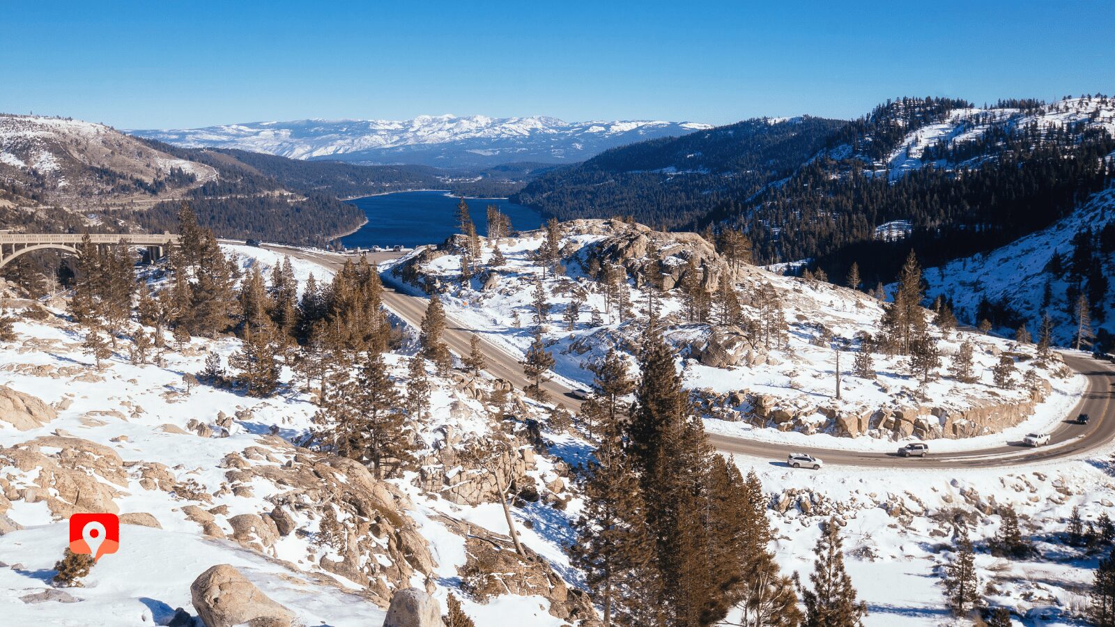
Regardless of the direction you’re coming from, all roads to Tahoe pass through the mountains. Drivers should always be mindful of inclement weather, especially in winter, when some combination of chains, all-wheel drive, and snow tires is recommended.
Reno
Reno-Tahoe International Airport (RNO) is the closest major airport, just 30 miles northeast of Tahoe’s north shore. It’s roughly forty-five minutes to the lake over the scenic Mount Rose Byway. Alternatively, take I-80 to the mountain town of Truckee (37 miles) and explore from there, or take a detour to the old Nevada mining town of Virginia City (23 miles), before picking up Highway 50 heading west to the lake. There are numerous car rental agencies at the airport.

Sacramento
Sacramento International Airport (SMF) is the next closest airport, and often has good deals on both flights and car rentals. Sacramento is about 120 miles west of Lake Tahoe, and is connected by both I-80 (North Shore) and Highway 50 (South Shore). The driving time for both routes is the same.
San Francisco
The San Francisco International Airport (SFO) is not particularly close, but it is certainly convenient if you plan on combining your trip to Tahoe with the Bay Area. The shortest route runs through the city before following I-80 northeast, past Sacramento. Remember that weekend traffic between the Bay Area and Lake Tahoe can be brutal, so try and organize your visits to avoid peak times. It’s roughly 200 miles from the airport to Tahoe.

The California Zephyr, which runs between Chicago and the Bay Area, has a stop in Truckee, about half an hour north of the lake. However, you’ll need a rideshare to get from the train station to Truckee’s car rental counter.


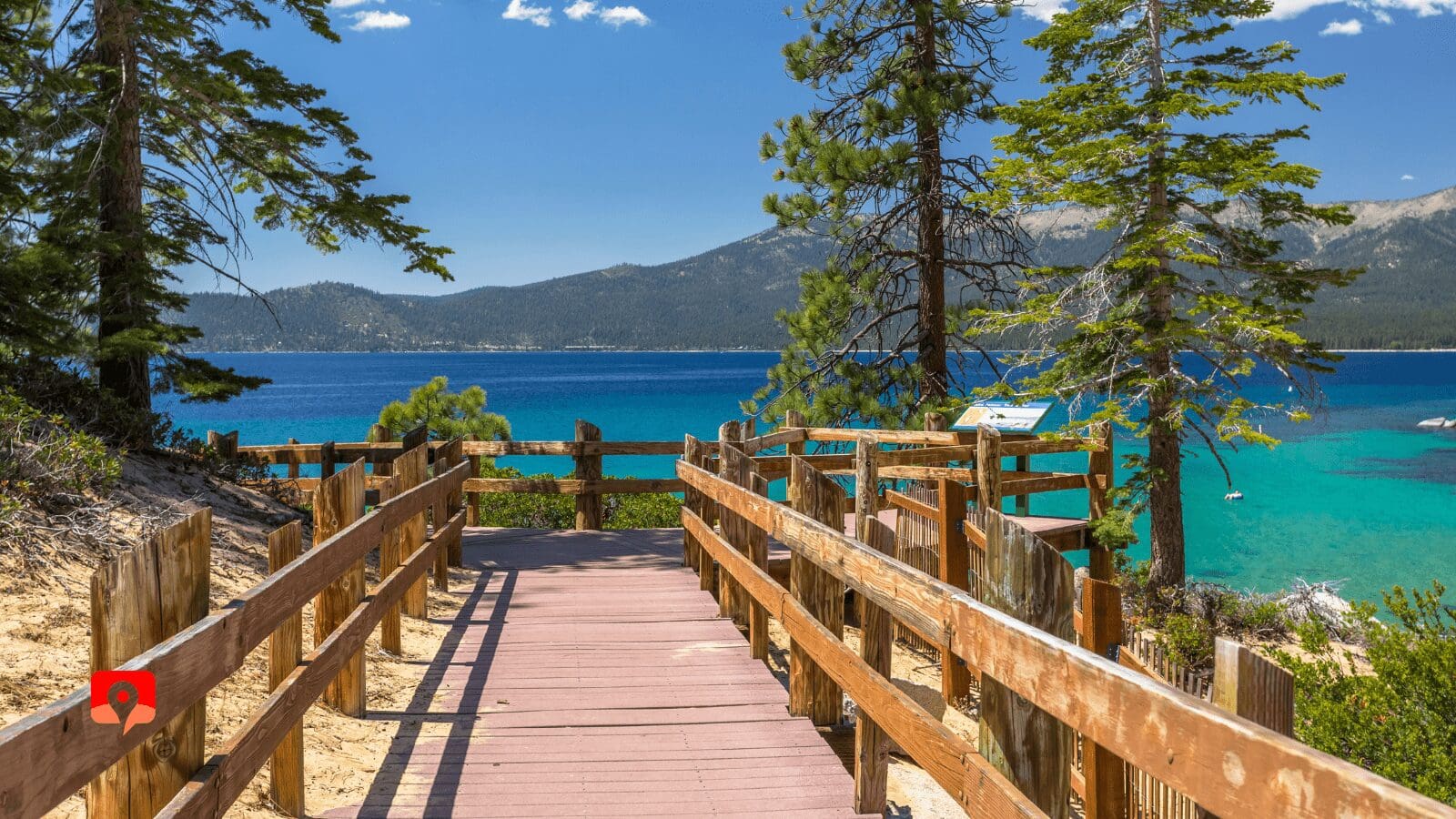
Many of Lake Tahoe’s most beautiful locations and beaches have been designated as state parks. Entry is reasonably priced, and paid per vehicle. Entry to historic mansions on park properties, like Vikingsholm or Ehrman, are usually a small fee as well.
California has a Tahoe Regional Pass which provides access to five parks on the California side. However, unless you’re a repeat visitor, this is unlikely to save you money. Even if you’re not entering a state park, you should expect to pay for parking in most touristy locations, including beaches and casinos.

Tahoe is open year round, with the shoulder seasons (April to May, and September to October) bringing pleasant weather with average temperatures in the 60s and fewer tourists.
Summer is the best time of year to lounge on beaches, float on paddleboards, and dip into the waters. Though with air temps in the 80s, and water temps in the 50s, swimming is always going to be a bit chilly – however, it sure beats 100 degree days in the Central Valley!
Winter, of course, brings heavy snowstorms and lots of ski traffic on the weekends. Make sure you are adequately prepared for driving in snow if you visit during this time.
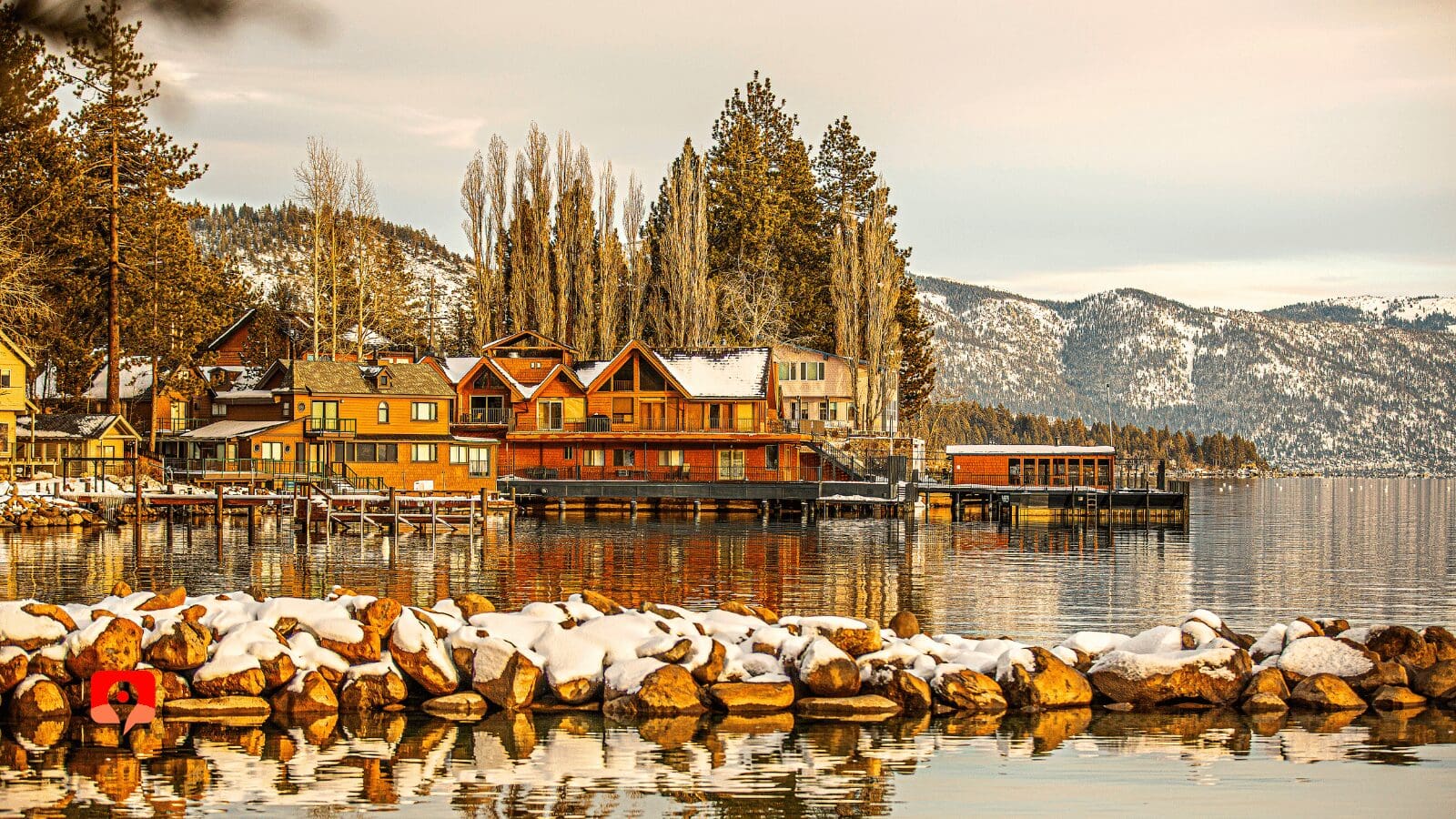
Accommodation is fairly diverse, ranging from campsites and rustic cabins to motels, casinos, ski condos, and luxury resorts. Vacation homes can be an interesting option, though like hotels, these tend to book up quickly, and may require a minimum-night stay in high season. South Lake Tahoe has the most options, while the North Shore tends toward more exclusive choices. Regardless of the time of year, you should always make reservations well in advance.
There are several campsites in the Tahoe area, including Sugar Pine Point State Park, Nevada Beach, DL Bliss State Park, Fallen Leaf, Campground by the Lake, and Zephyr Cove. Campers must be bear aware and secure all food properly.


While you could do our driving tour in a single day, most visitors will want to spend at least two days and two nights here to get the most that Tahoe has to offer. For the full experience, four days is recommended.
At only 72 miles long, the Tahoe loop is relatively short, and can be completed in as little as three hours. But if you want to stop to enjoy the different detours and outdoor activities, you’ll want to spend at least two days here. Hiking, kayaking, standup paddleboards, pleasure cruises, cycling, museums, and a casino or two will all vie for your attention.
Overall, we would recommend a day spent exploring the trails, parks, and historic sites in south Tahoe, and another day divided between a detour to Donner Pass and the wild beaches of the east shore. Other detours to explore include Virginia City, the Mount Rose Scenic Byway, Reno, and the Desolation Wilderness.
Lake Tahoe averages fifteen million visitors per year, and the busiest months unsurprisingly coincide with the summer and winter vacation seasons. Parking can be a major challenge, as lots are often small, particularly in the state parks. It is not uncommon for visitors to park illegally on the side of the road in particularly popular areas, like Emerald Bay.
No matter where you go, we recommend waking up at dawn and visiting at least one major highlight before 9am. Likewise, prioritizing a visit during the week rather than the weekend is ideal. Friday night rush hour and Sunday afternoon are peak times for getting to and from the lake, and should be avoided at all costs.

Castles, waterfalls, and beaches, oh my! Whatever your fancy, you’ll be sure to find it at Tahoe’s most popular park: Emerald Bay. This stunning glacier-carved cove has one photogenic vista after another. Whether you’re on a tour of the Scandinavian-inspired Vikingsholm (built 1929); admiring Tahoe’s only island, Fanette, from Inspiration Point; or idly floating on an SUP while soaking up some rays, you can’t go wrong.
One of Emerald Bay’s most unique sights is the maritime heritage underwater trail for snorkelers and divers, which passes the wrecks of various barges and boats beneath the surface. Hikers can take in the famous Rubicon Trail, Lower Eagle Falls, Upper Eagle Falls, and Eagle Lake in the Desolation Wilderness. It is busy, however, so be sure to arrive before 9am.
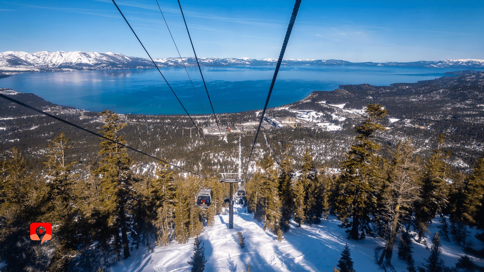
You don’t have to be a skier to enjoy fresh air and alpine views. With over a dozen ski resorts in the Tahoe area, there are plenty of choices to take in the high country, but the most famous ride of all is the Heavenly Gondola.
Climbing 3,000 feet in 12 minutes, and traveling 2.4 miles from the lake shore to the observation deck and Tamarack Lodge, the eight-seat gondola is the fastest – and least demanding – option for getting into the mountains.
Open year round, the summer season features an adventure park, hiking trails, and a second chair lift that climbs even higher than the gondola.
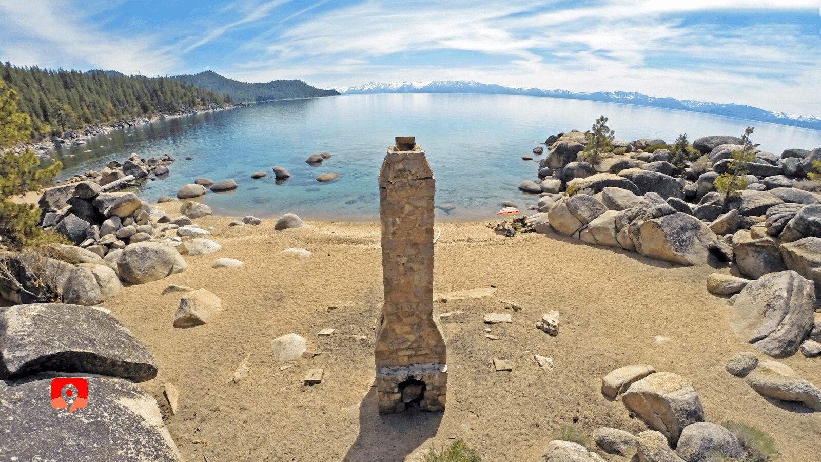
Chimney Beach is arguably the most fabulous of Tahoe’s undeveloped beaches. Named after the remains of the old caretaker’s cabin, this sheltered cove of giant boulders and glittering turquoise waters casts its spell on all who visit.
The half mile hike down is a bit steep and the trail can be tricky to follow, but persevere and you’ll make it. The hike down from the parking lot and the hidden coves stretching in both directions allow for some degree of solitude.
One mile south along the shore from Chimney Beach is the clothing optional Secret Cove. The only catch? The parking lot fills up early.
Donner Pass is the site of a key passage through the Sierra Nevada range, and as such has witnessed some epic moments in American history, ranging from the tragic fate of the Donner Party to the construction of both the first transcontinental railroad and transcontinental highway.
Today, you can stop off at the Donner Memorial State Park and Lake, which is home to an engaging museum, or you can keep driving up the old highway to see the remnants of the original railway tunnels blasted out by Chinese immigrants, ancient petroglyphs, and a trailhead for the famous Pacific Crest Trail, the 2,650-mile-long through hike, which stretches from Canada to Mexico.
Get a taste of the lifestyles of San Francisco’s rich and famous…one hundred years in the past. Three vacation homes – the Baldwin, the Pope, and the Valhalla – stand amid towering old growth trees at the Tallac Historic Site on Tahoe’s south shore. At the turn of the 20th century, a casino, ballroom, croquet courts, and steamer cruises kept well-heeled guests entertained.
During the summer months you can tour the mansions or catch a concert en plein air, but the grounds remain open throughout the year and always make for an interesting stroll. Nearby is the public Kiva Beach, with fabulous views of the Desolation Wilderness beyond.
Right next door to the Tallac Historic Site is this nature center, and connected by a fifteen-minute walk, where you can choose from four different hikes.
The highlight is the half-mile Rainbow Trail, whose claim to fame is the stream-viewing chamber: a window into the underwater world of Taylor Creek, where you’ll be able to see trout and other aquatic critters going about their business.
In fall, the Kokanee salmon pass through, on their way to spawn upstream. Also here is the Forest Tree Trail, a quarter-mile loop that introduces the ecosystem of the Jeffrey Pine, the dominant tree in the Tahoe Basin. Across the road is a longer hike to Fallen Leaf Lake.
This is a great stop for nature enthusiasts – don’t miss Old Veteran, a giant Jeffrey Pine in the Taylor Creek parking lot. This tree is at least 350 years old, and was spared the logger’s saw because of its unusual double-barrelled trunk.

If you’re making the trip between Tahoe and Reno, definitely take this scenic drive over the Mount Rose Summit Pass on Highway 431. The pass crests the Carson Range at 8,911 feet, nearly 2,700 feet above Lake Tahoe, and 4,400 feet above Reno. High-altitude views, one of the United States’ first alpine weather stations, and plenty of hiking opportunities – from the Tahoe Rim Trail to the Mount Rose Summit – await.
The Gatekeeper’s Museum in Tahoe City has two main collections: a collection of Native basketry, and a small display related to the 1960 Winter Olympics. The 270 handwoven baskets, most of which date from the turn of the twentieth century, range from Arizona to British Columbia, exhibiting an array of traditional designs.
Just next to the Gatekeeper’s Museum is Fanny Bridge, which crosses Lake Tahoe’s only outlet: the Truckee River. Fanny Bridge originally got its name from – you guessed it – the backsides of all those tourists peering over the bridge at the trout in the Truckee River!
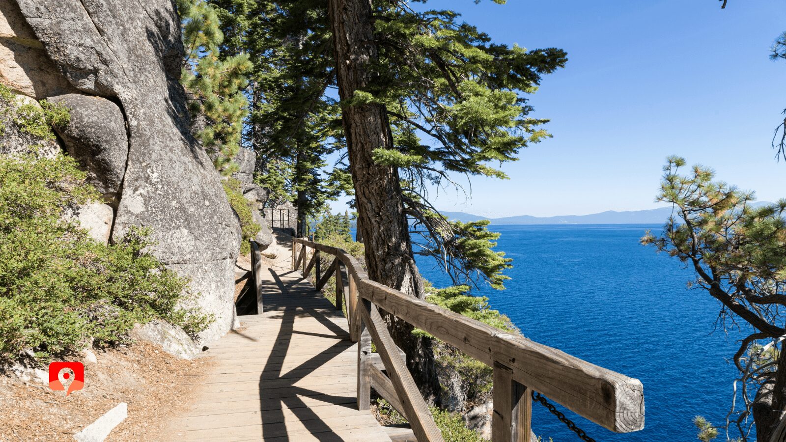
Following the shoreline between Emerald Bay State Park and DL Bliss State Park, the Rubicon is often named Tahoe’s best hike. You can link up all sorts of sights along the way, from the Vikingsholm Mansion and Lower Eagle Falls in Emerald Bay to a ruined 1916 lighthouse in DL Bliss.
Truthfully, the lighthouse is not much to look at – many visitors think the old wooden structure is an outhouse! However, this was once the second-highest lighthouse in the United States.
If you set up a car shuttle (parking may be a challenge), you can just do the hike one-way (4.5 miles). If not, you’ll need to hike round trip, which is a total of nine miles.
Completed in 2019, the gorgeous East Shore Trail runs for three miles between Incline Village and Sand Harbor, offering easy access to eleven semi-wild beaches and seventeen vista points as it meanders through Lake Tahoe Nevada State Park. It is paved and wide, making it bicycle, wheelchair and pedestrian friendly.
If you’d like to visit Hidden Beach, walking or cycling from here is the only option. At the trail’s terminus is Sand Harbor State Park, where you can rent kayaks and stand-up paddleboards.
In 2023, Nevada State Parks is implementing a day-use reservations system for select parks, including Sand Harbor. Visit the Nevada State Parks website for further details.
This short half-mile walk is paved most of the way, heading up a gentle incline and ending at the site of an old fire lookout, with awesome views of the lake. The fire lookout was one of three in the Tahoe area and was originally built in 1936. It was dismantled in 2002. There are bathrooms and a short nature trail at the top.

At 165 miles in length, most people probably aren’t going to hike the whole Tahoe loop… but don’t let that number stop you from exploring a much shorter section. Completed in 2001 after more than twenty years of planning and through the help of 20,000 volunteers, the Rim Trail remains one of Tahoe’s signature experiences.
One of the easiest places to hop on is in Tahoe Meadows, accessed from the Mount Rose Scenic Byway. An easy interpretative loop here is only a mile and change and wheelchair accessible. With wetlands sections crossed on a boardwalk, this is a great spot for birders.

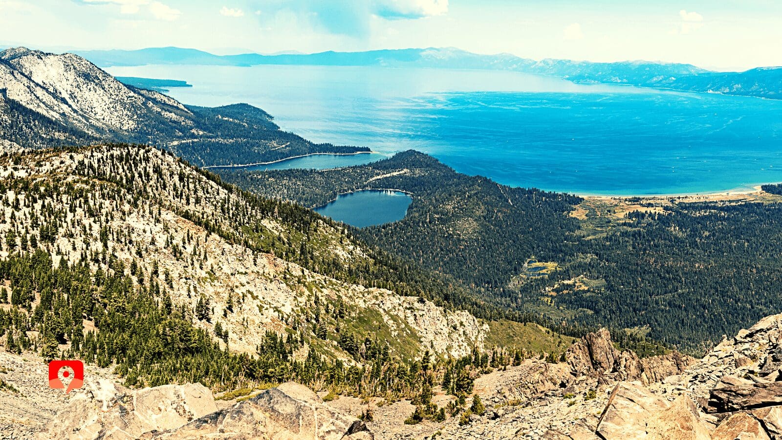
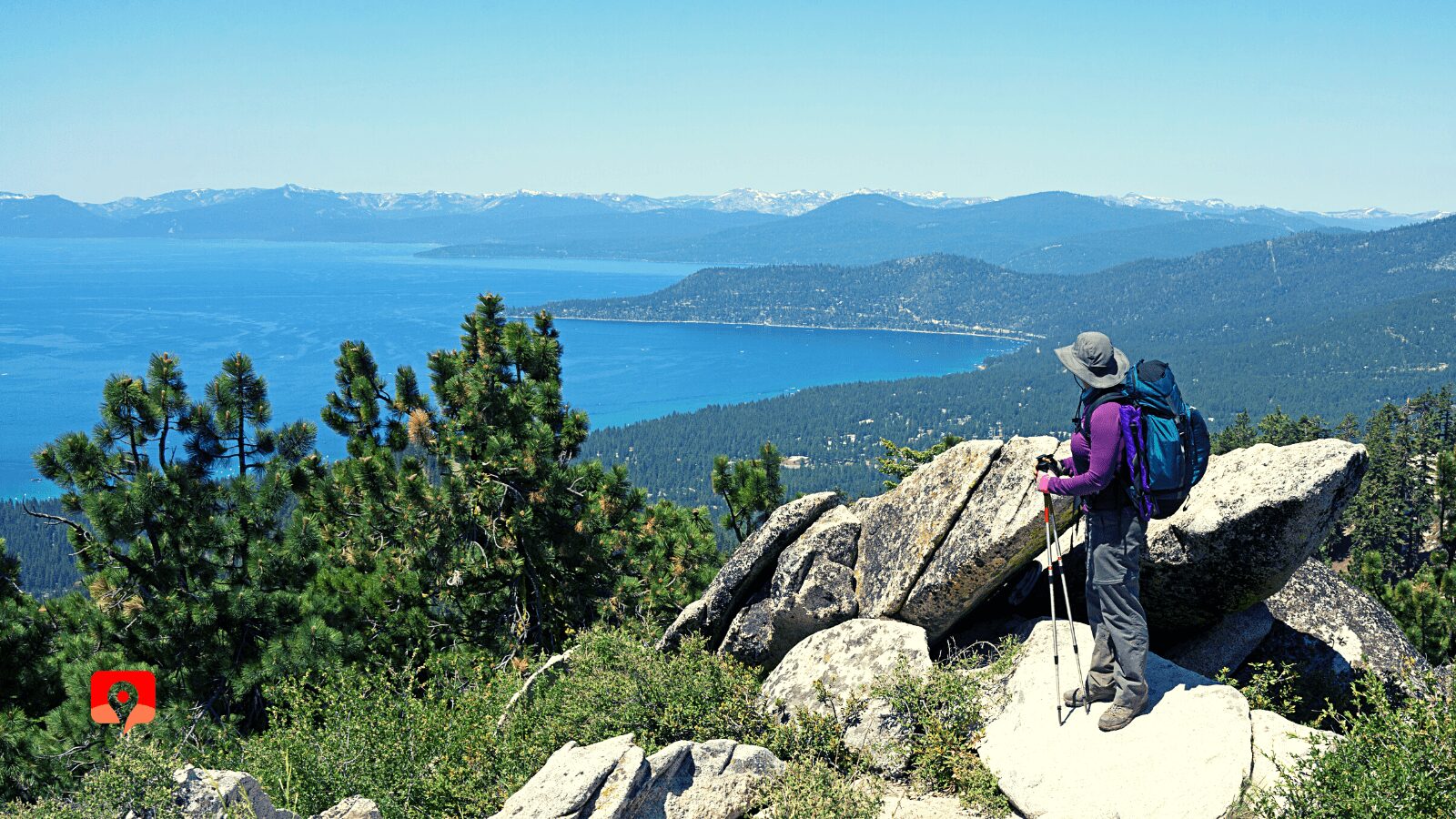
No pain, no gain. This particular adage is an apt description of the challenge facing hikers looking to bag Mount Tallac, the South Shore’s most iconic peak. Rising to a height of 9,738 feet Tallac gets its name from the Washoe word for “great mountain.” One of the most popular hikes in the area, Mount Tallac sees some 10,000 visitors annually. But don’t let that number fool you – although it’s only five miles one way, the elevation gain is a hefty 3,300 feet from the trailhead. Get ready to level up your Stairmaster workout! Views along the way include Fallen Leaf Lake, Cathedral Lake, and of course, the mesmerizing expanse of Tahoe itself.
There are two Eagle Falls – an upper and a lower – and both are worth the trip. Upper Eagle Falls is smaller but closer (about a quarter of a mile hike one-way), and is usually combined with a trip to Eagle Lake, which is an additional three-quarters of a mile uphill. Lower Eagle Falls is part of Emerald Bay State Park, and can only be reached by hiking one mile down to the beach, and then circling around to see the double-stage waterfall from below.

If you’re crazy for alpine panoramas, this is another popular summit in the Tahoe area. At 10,776 feet, it’s a full 1,000 feet higher than Mount Tallac. However, because the trailhead is Mt Rose Pass, you don’t have to work quite as hard… there’s only 2,500 feet of elevation gain! Nevertheless, this is considered a challenging hike: it’s eleven miles round trip, and the high altitude can leave even the fittest hiker gasping for breath.
Dinner cruises, history cruises, scenic cruises, and fireworks extravaganzas… there’s no shortage of options if you’re looking to get out on the water. Boats range from massive Mississippi-style paddle-wheelers to small exclusive yachts, and leave from various points around the lake.

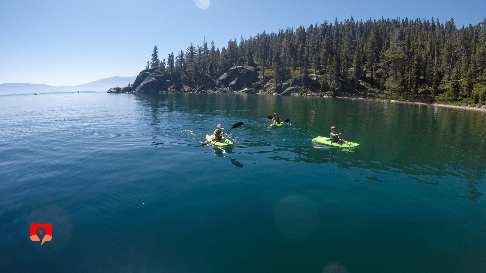
Seventy-two miles of watery fun: squeeze into a kayak or pop onto a standup paddleboard to follow Tahoe’s official water trail. This route is one of the most unique ways to experience the lake, though you don’t have to be an Olympic athlete to give it a shot. It’s divided into seven segments, each presented as a possible day trip.
Tahoe has a full lineup of festivals throughout the year, but perhaps the most well known is the Shakespeare Festival, running from July through August. The outdoor stage is at Sand Harbor State Park, on the east shore in Nevada. Book tickets well in advance. If dancing is more your style, Harvey’s Casino hosts a popular outdoor concert series from June through August, bringing in star performers.

If you’re interested in checking out the wrecks of yesteryear or Tahoe’s unique underwater topography, sign up for a dive or two with a local outfitter. Diving at altitude presents its own set of challenges, and Tahoe’s depths are, shall we say, on the chilly side, so you definitely want to be sure you are properly equipped.
Tahoe is no Vegas, but the laid-back vibe and smaller casinos may appeal to some who want to pass an hour or two at the blackjack table without any faux Eiffel Towers or dancing fountains. The largest concentration of casinos is in Stateline, along the South Shore. Have fun, but remember: the house always wins.
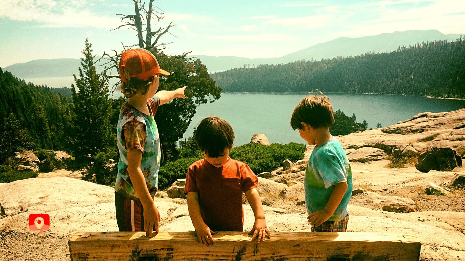
Tahoe keeps kids of all ages entertained: boating, mountain biking, skiing, and swimming are just some of the ways to stave off boredom. Wherever you go and whatever you do, make sure you always bring plenty of sun protection and water.
Staying cool in the water, or paddling around on a boat, the beach is the most surefire way to keep everyone happy. Developed beaches have easy access to cars, restrooms, showers, picnic tables, barbecue grills, volleyball courts, and boat rental. You usually have to pay for either parking or entry, but the amenities make it worth it.
Undeveloped beaches that you have to walk to – such as along the East Shore Trail – may be less convenient, but they’ll also be less crowded. These are usually best for older children who can be counted on to carry some weight.

Younger kids will love the aquarium-like experience along the Rainbow Trail, where they can peer into the river to spy on fish, frogs, beaver dams, and other aquatic life. Afterward, take the nature trail and collect some giant pine cones.
For a truly unique experience, check out this ropes course in the forest. With 10 courses, 27 zip lines, 97 tree platforms, and dozens of bridges, the adventure park screams fun at max volume (sometimes quite literally). Courses range from beginner to advanced: as long as participants are over six, a good time is virtually guaranteed. There are three locations in the Tahoe area: at Tahoe City, Palisades Tahoe, and Tahoe Vista.
The largest ski resorts in the area turn into high-altitude adventure playgrounds in the summer, usually offering some combination of ropes courses, gravity coasters, disc golf, geocaching, tubing, and mountain biking. A new via ferratta course – which offers all the excitement of rock climbing and mountaineering, without the complexity – is located in Palisades Tahoe.
Mountain biking in Tahoe is, simply put, awesome. From Northstar’s bike park to the legendary Flume Trail and Mr. Toad’s Wild Ride, to long-distance hauls like the Tahoe Rim Trail, bikers have a solid choice of options to explore. But you don’t have to be able to bunny hop over giant boulders to enjoy two-wheeled fun. Paved bike paths and rental outfits can be found near all the major towns in the Tahoe area, and are suitable for anyone able to ride a bike. Shorter segments like the East Shore Trail and the Pope Baldwin Bike Path can be great ways for families to explore the lake.

This giant granite formation juts over the East Shore, and its 250-foot vantage point gives it a distinct edge when watching the sun set over the mountains. Sacred to the Washoe Natives, Cave Rock was originally known as De’ek Wadapush, or Standing Gray Rock. To get here, count on a fifteen minute hike; the last hundred feet require some rock scrambling, so don’t undertake this section if you have a fear of heights.
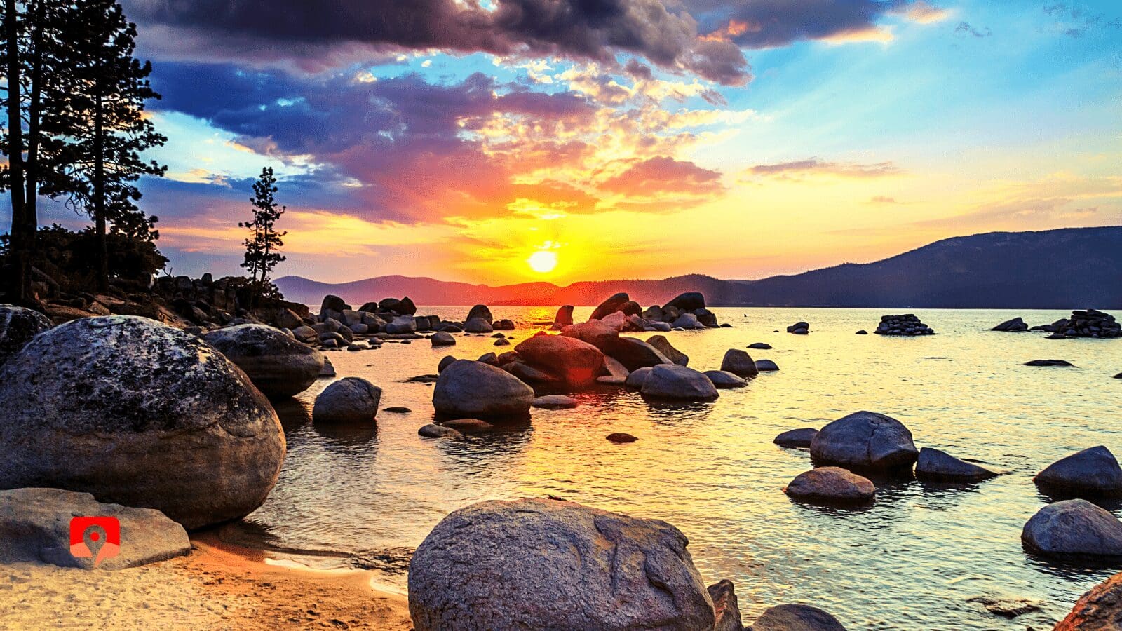
Also known as El Dorado Beach, this public strip of sand in South Tahoe is a great spot to watch the sky light up in pastel shades while a band performs on the outdoor stage, or you’re firing up the grill for dinner.

Hike out to this pedestrian-only strip of sand, accessed from the East Shore Trail near Incline Village. Hidden Beach is one of the more peaceful spots in North Tahoe to enjoy the sunset – the boulder-strewn water on a calm day mirrors the sky perfectly.
If you’re an early riser and reasonably fit, consider hiking to Upper Eagle Falls to catch the sunrise. Although it’s only a quarter of a mile, the trail is definitely steep in places. This may be the only time of day you’ll have it to yourself.


Warm Layers: Tahoe is at 6,000 feet, so expect evening temps to get cool, even in the summer. Always keep an extra layer and a rain jacket in the car, just in case. In winter, be sure to bring long underwear, a fleece, puffy, hat, gloves, and outer shell.
Footwear: You’ll need at least two styles – trail shoes or boots for hiking, and water shoes or sandals for the beach. When it comes to hiking shoes, note that some people prefer boots, which provide ankle support, while others opt for trail-running shoes, which are lighter weight but still have grippy soles. Either way, make sure that your shoes are snug and that they have a good sole. In winter, snow boots are recommended.
Beach Supplies: Swimsuit, towel, rash guard, beach chair, and swim goggles.
Daypack: A comfortable pack makes all the difference. In addition to carrying an extra layer, water, and headlamp, it’s a good idea to throw a few snacks in there as well.
Headlamp: You never know when a hike is going to take longer than planned – we always throw a lightweight headlamp in our daypack just in case.
Hiking Poles: Light-weight hiking poles are like having a third leg. They help maintain balance and can get you into a rhythm while walking.
Sun Protection: This essential includes a broad-brimmed hat, sunblock, and sunglasses. Even on cloudy days, wearing sunscreen is important because of the high elevation.
Water Bottles: Always bring water. And make sure you drink it! No matter what time of year you visit, dehydration is always a risk – even if you’re not doing much physical activity. In summer, it’s recommended that you drink a gallon a day.
Portable Phone Charger and Cable: If you’re taking pictures with your phone, running out of batteries may result in missed opportunities. A DC car charger is best, so that you can charge your phone while driving.
Plastic Bag: We always carry a plastic bag when we hike, so we can do our part and help keep the trails and waterways clean. If you see some trash along the way, pick it up, drop it in the bag. When you get back to the trailhead, simply drop your bag in the recycling or trash bin and voila! You’ve helped keep the parks beautiful for everyone who visits.
